AS SEEN ON


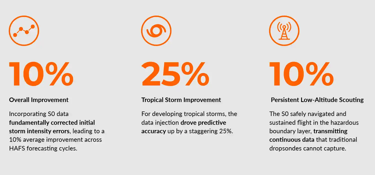
Ahead of the 2026 hurricane season, NOAA has officially integrated data from Black Swift Technologies’ S0 UAS into its operational forecasting system, unlocking an unprecedented 10% boost in hurricane intensity tracking.
Every time a hurricane threatens the coast, the economic stakes are monumental. The potential annual cost of evacuating just 417 miles of coastline is approximately $1.5 billion. Yet, typically, hurricane-force winds actually impact only about 25% of the area placed under a warning.
The average cost of a hurricane is:
The average cost of a hurricane is
$ 1 Billion
An evacuation zone that is drawn too broadly can cause evacuation fatigue, leading citizens to ignore warnings after previous false alarm. Too narrow, and vulnerable lives are put at extreme risk.
An evacuation zone that is too broad can cause evacuation fatigue, leading citizens to ignore warnings after previous false alarms. Too narrow, and lives are put at extreme risk.
For millions, precise hurricane forecasting is the difference between life and death.
For millions, precise hurricane forecasting is quite literally the difference between life and death.
A leap for forecasting
Advancing Hurricane Forecasting Accuracy
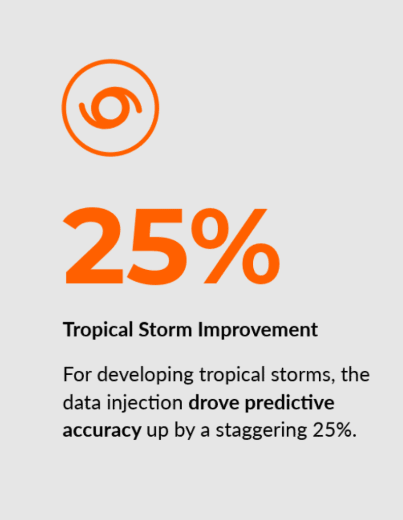
Integrating BST's S0 UAS data into NOAA’s premier hurricane model, HAFS (Hurricane Analysis and Forecast System), delivers up to a 25% improvement in tropical storm forecasting and a 10% gain in hurricane forecast accuracy, creating critical lead time for coastal protection and emergency response.

A Critical Breakthrough
Braving the Challenging Boundary Layer
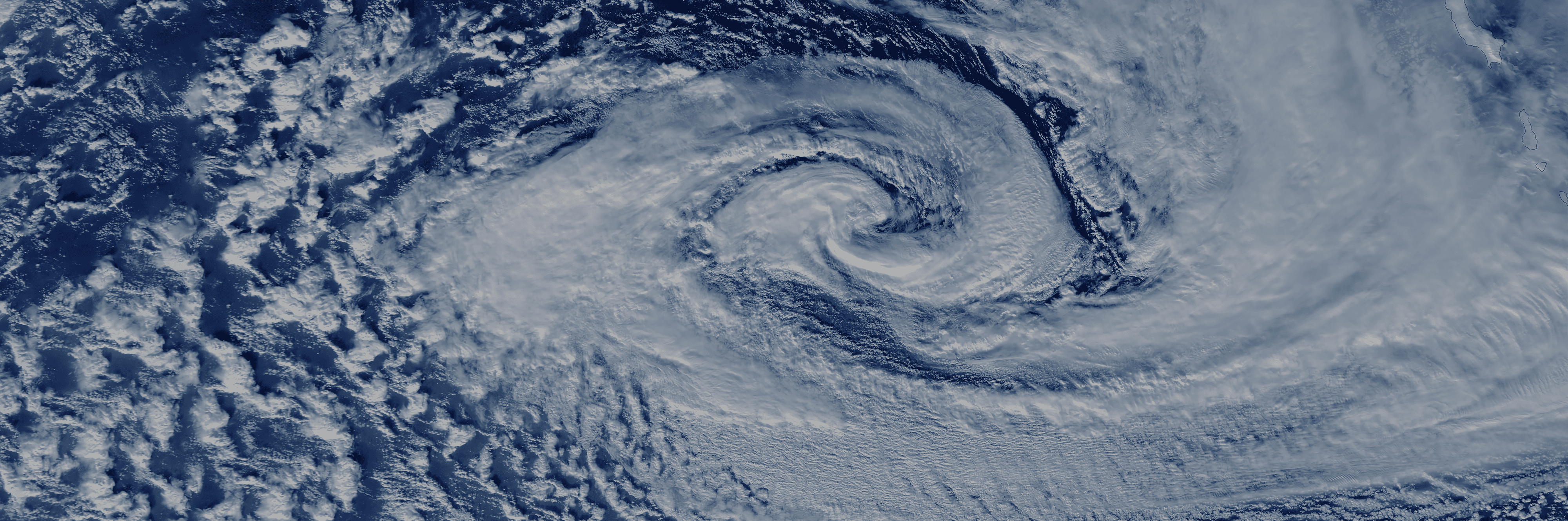
Accurate hurricane prediction saves lives and safeguards billions in coastal infrastructure. Yet, for decades, meteorologists have faced a critical data gap: the marine boundary layer.
Accurate hurricane forecasting saves lives and safeguards billions in coastal infrastructure. Yet, for decades, meteorologists have faced a critical data gap: the marine boundary layer.
This turbulent zone where the ocean’s warm water feeds energy directly into a storm is too dangerous for crewed Hurricane Hunter aircraft to fly in, and too chaotic for satellites to accurately see.
This turbulent zone where the ocean’s warm water feeds energy directly into a storm is too dangerous for crewed Hurricane Hunter aircraft to fly in, and too chaotic for satellites to accurately see.
Without real-time atmospheric data from this exact zone, forecasting models struggle to predict rapid intensification.
Without real-time atmospheric data from this exact zone, forecasting models struggle to predict rapid intensification.
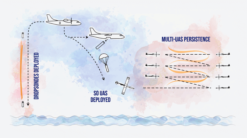
That is exactly where the S0 UAS steps in.
That is exactly where the S0 UAS steps in.
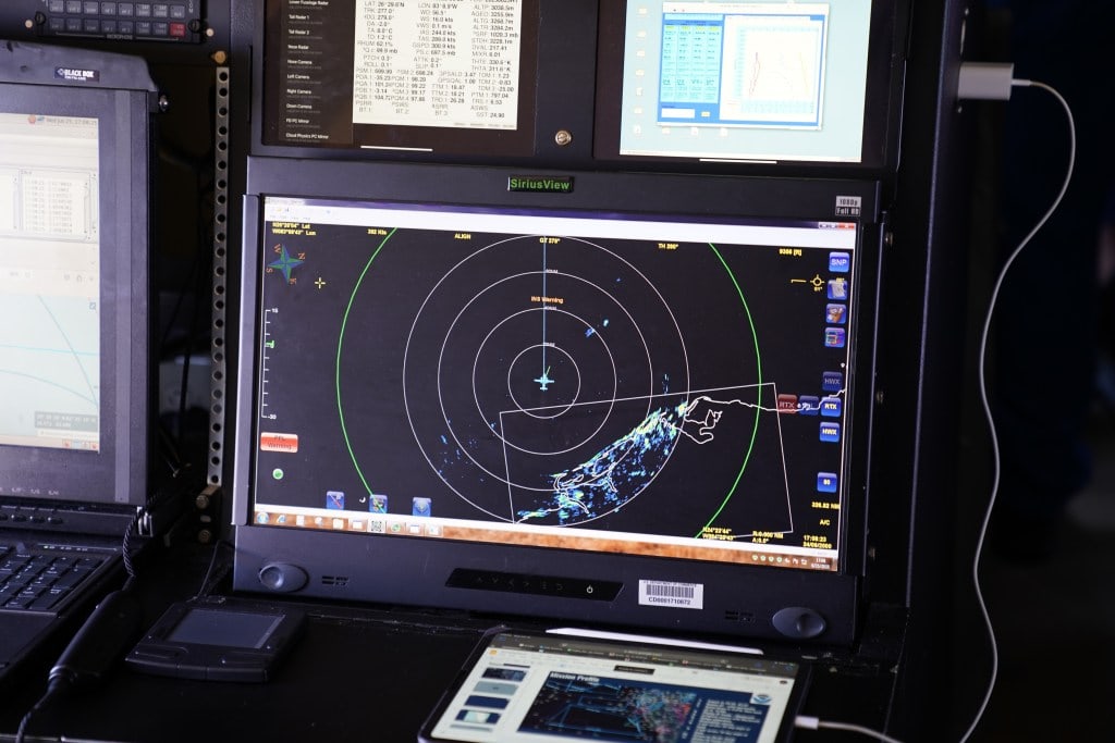
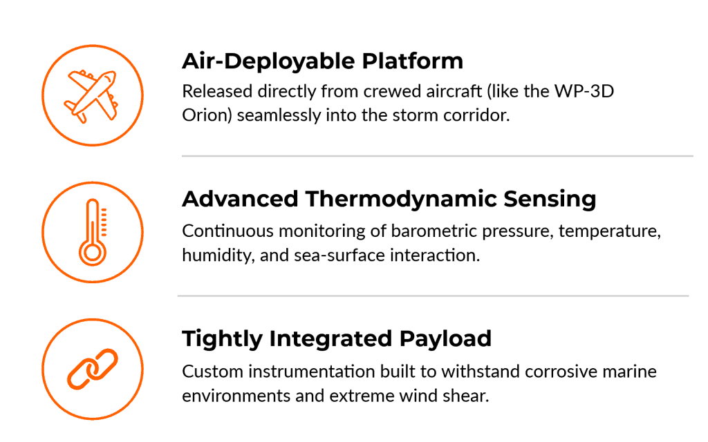
Once launched, the drone flies autonomously as low as 20 to 30 feet above the waves, continuously measuring pressure, temperature, humidity, 3D wind vectors, and sea surface temperatures in an environment too dangerous for crewed planes.
During the 2025 hurricane season, the S0 shattered multiple operational limits, setting a new endurance record by flying for approximately two hours (119 to 120 minutes) inside a hurricane and establishing a record communications range of 247 miles.
The Data
The Proof: Independent NOAA Validation
In a newly published breakthrough study, NOAA’s Atlantic Oceanographic and Meteorological Laboratory (AOML) and the Cooperative Institute for Marine and Atmospheric Studies (CIMAS) evaluated the impact of deploying our S0 unmanned aircraft system (UAS) directly into the eyewalls of major storms.

By utilizing the S0’s specialized Multi-Hole Pressure Probe (MHPP) to capture precise air-sea flux measurements, researchers ran retrospective tests within the Next-Generation Hurricane Analysis and Forecast System (HAFS).

HOW IT WORKS
Built for the World's Harshest Environments

Get The DataSheet
Put Proven Atmospheric Data to Work for Your Mission
Submit the contact form to receive our S0 UAS Data Sheet to share with your procurement or program management team.