Modular by Design, Accurate by Nature™
Using different sensor payloads which, by design, are easily interchangeable, BST delivers UAS solutions specifically engineered to measure selected gases and atmospheric parameters including pressure, temperature, humidity (PTH), and 3D winds, as well as more advanced measurements such as particle sizing and trace gases.
The existence of a UAS capable of carrying the necessary instruments routinely through harsh environments adds an invaluable contribution to the calibration and validation of data collected from ground and satellite-based methods.
Black Swift Technology’s UAS have been utilized for scientific research by federal and state agencies and other government-funded laboratories to collect data on coherent atmospheric structures such as volcano plumes, wildfire smoke, soil moisture content, etc. Commercial applications for private industry include using a UAS to assess the composition, and relative danger, of chemical fires at refineries or the chemical composition of smokestack exhaust.
Atmospheric Monitoring
The Black Swift S2 UAS was engineered from inception to meet the demands of high altitude flights through strong winds and damaging airborne particulates typical of nomadic scientific field campaigns.
These harsh environments have demonstrated to NASA, NOAA and similar scientific agencies (all requiring a high degree of precision, accuracy and reliability) that this purpose-built platform is designed to effectively capture atmospheric data in the most challenging environments.
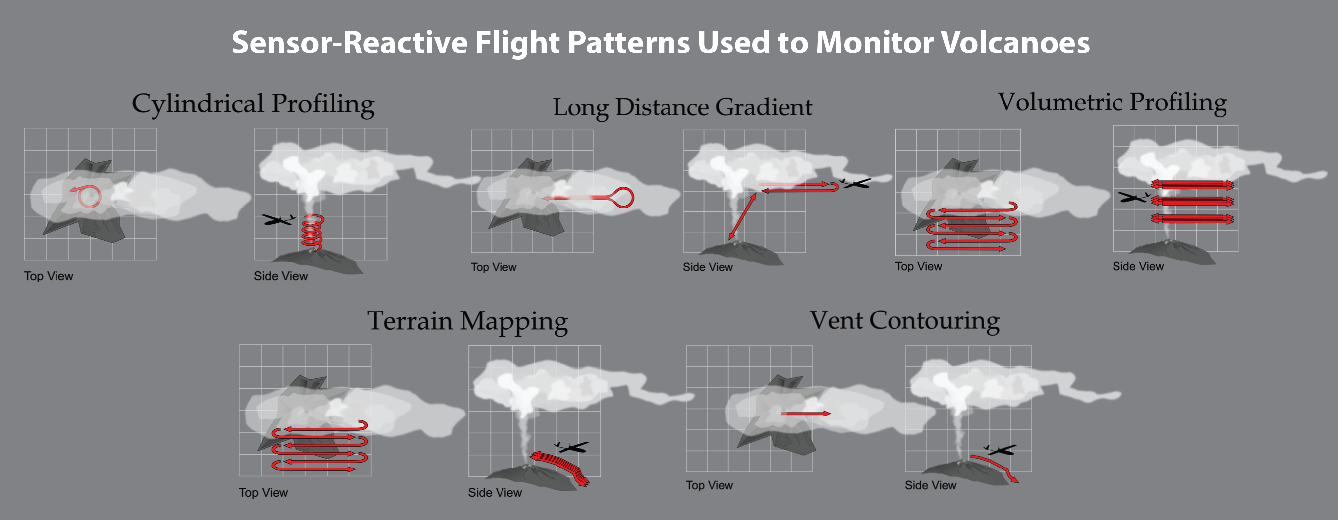
From arctic conditions gathering snow and ice aerial measurements, to flights over and around volcanoes measuring select gases and atmospheric properties, the S2 has proven itself to meet or exceed the expectations of our most demanding clients. Our aircraft have been deployed in 72 different flights in supercell thunderstorms, two of them tornadic; relied upon for wildland fire observations, hurricane monitoring, and mapping missions at altitudes exceeding 14,260 feet (AGL)—all utilizing sensor-reactive flight patterns.

Volcano Monitoring
Collaborating with NASA Jet Propulsion Laboratory (NASA/JPL), the S2 was used to capture airborne carbon dioxide (CO2) measurements via a UAS over an active volcano. By measuring and monitoring the prevalence of volcanic gases like CO2 emitted from active volcanoes, NASA/JPL hopes to use this data to better understand and predict the likelihood and impact of volcanic eruptions.
Flights were conducted in Costa Rica using Black Swift’s most advanced UAS, the Black Swift S2 (Figure 1), equipped with a variety of sensors designed to measure gases such as sulfur dioxide (SO2), methane (CH4), hydrogen sulfide (H2S), and carbon dioxide (CO2) being emitted by the volcano. In addition, the S2 also carried a nephelometer to assess volcanic particle size and distribution, as well as atmospheric probes to analyze pressure, temperature, humidity (PTH), and three-dimensional (3D) wind patterns.
While emission rates can be monitored and measured from the ground, accurate data collection on volcanoes can be hazardous as crater temperatures reach extreme levels. These flights demonstrated that a purpose-built UAS can accurately measure the compounds present in the gas plumes above volcanoes in a safer and more repeatable manner than surface methods.
Wildland Fire Observations
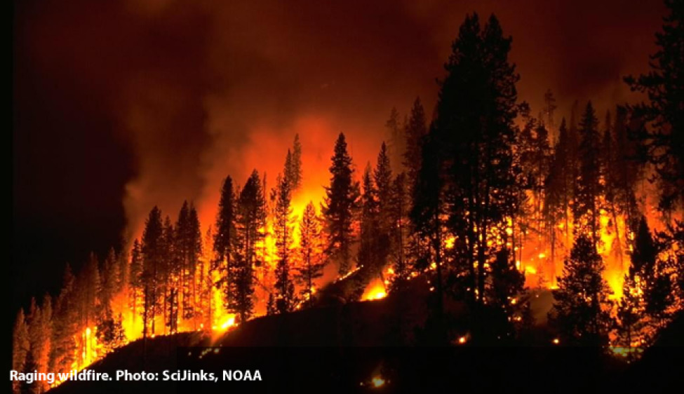
The National Oceanic and Atmospheric Administration (NOAA) uses the Black Swift S2 as the small UAS Observation System (sUASOS) for wildfire measurements in support of their FIREX and NightFOX field missions, as well as their fire weather forecasting initiative.
The S2 was fitted with sensors specifically designed to capture and measure a variety of gases including CO2, CO, aerosol, RH, p, and T found in the wildfire plumes, while also providing multispectral high-resolution maps of wildfires.
The ultimate goal of NightFOX (Nighttime Fire Observations eXperiment) is to perform nighttime in situ measurements of wildfire plumes and remote measurements of wildfire properties, and use of the measured data for fire weather forecast improvement, while NOAA’s Fire Influence on Regional and Global Environments Experiment (FIREX) uses the S2 to characterize nighttime fire emissions and fire characteristics.

S2 provides wildfire measurements in support of NOAA’s wildfire measurements and fire weather forecasting initiatives.
Atmospheric Research Services
Black Swift Technologies and the University of Colorado (CU) Boulder Integrated Remote and In Situ Sensing (IRISS) offer a cost-based service program providing scientists and researchers access to the combined resources of one of the nation’s leading atmospheric research universities and the developer of the premier UAS Flight Management System and advanced aerial platforms specifically designed for atmospheric science-based missions.
This collaborative, supportive approach serves as the foundation for a new research paradigm centered on atmospheric research providing researchers and scientists access to highly specialized unmanned aerial research equipment without the burden of acquisition costs or ongoing maintenance fees.
Modeled after the burgeoning subscription-based business model, CU’s Atmospheric Research Service Initiative provides scientists and researchers access to one of the largest and most diverse fleet of UAS specifically designed for atmospheric sensing along with one of the nation’s leading ground support offerings (cars, personnel, calibration equipment and towers, etc.). This team, whose customers include NASA, NOAA, JPL, UTSI, NPS, DOI, and leading research institutions worldwide, can address almost any foreseeable atmospheric science requirement from simple data acquisition through full-service custom payload installation and operation.
This alliance delivers unheralded UAS research experience, personnel, avionics, payload and sensor capabilities, coupled with the UAS flight control infrastructure previously unattainable in a unified resource.

Program allows researchers and scientists the freedom to focus on the science of their programs versus the logistics.
“By capitalizing on our strengths in aerospace engineering and earth sciences together with Black Swift Technologies advanced flight management avionics, sensor integration and their purpose-built scientific research airframes, we can support a wide range of atmospheric science initiatives at a time where rapid technological advances keep many of these capabilities out of reach of typical researchers and scientists.”
Cory Dixon, PhD
IRISS Chief Technologist
A Truly Integrated Solution
Leveraging BST’s proprietary Mission Planning Software, scientists can program BST’s UAS in minutes to indicate the area under review and then begin collecting data for immediate analysis and decision making.
With its intuitive tab-driven interface, flight planning is simple and easy to accomplish. Mission monitoring and mapping is all done from a handheld Android™ Tablet loaded with BST’s SwiftTab™ software. Gesture-based controls enable users to confidently deploy their UAS with minimal training while being able to collect data over geography that is topically diverse with confidence.


